Hello Everyone!
Today was one of the most enjoyable days I have ever spent. I just downloaded the pictures from my digital camera into the computer and I took over 350 pictures just today. It began early this morning just after sunrise when I flew from Las Vegas to the Grand Canyon on a small twin engine plane. Below you can see Lake Mead and the small Boulder City Airport where we had just taken off from.
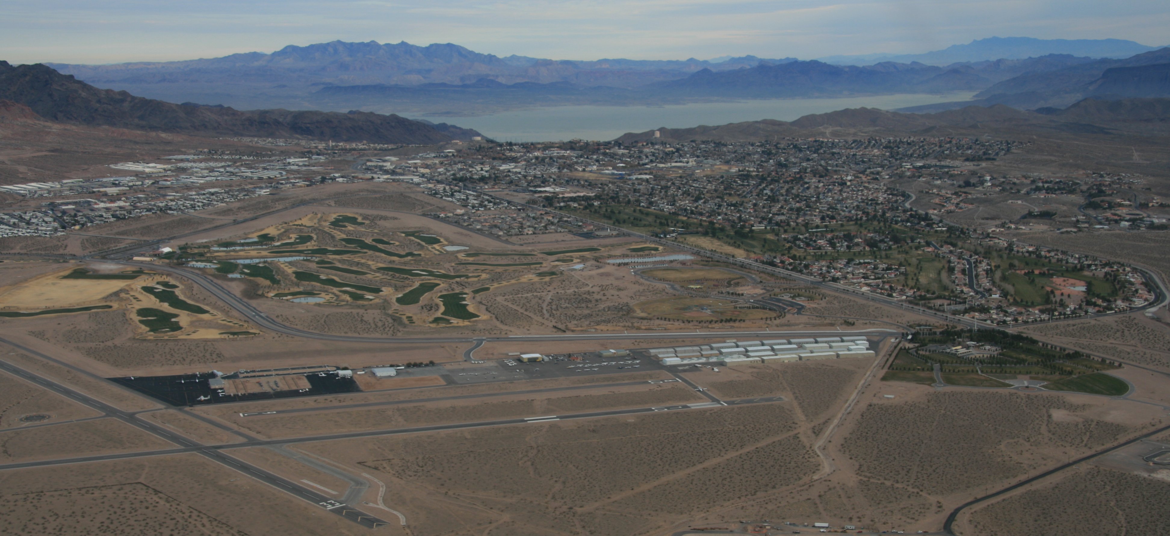
The flight to the Canyon took about an hour and fifteen minutes. We flew over Hoover Dam on the way for some great views.
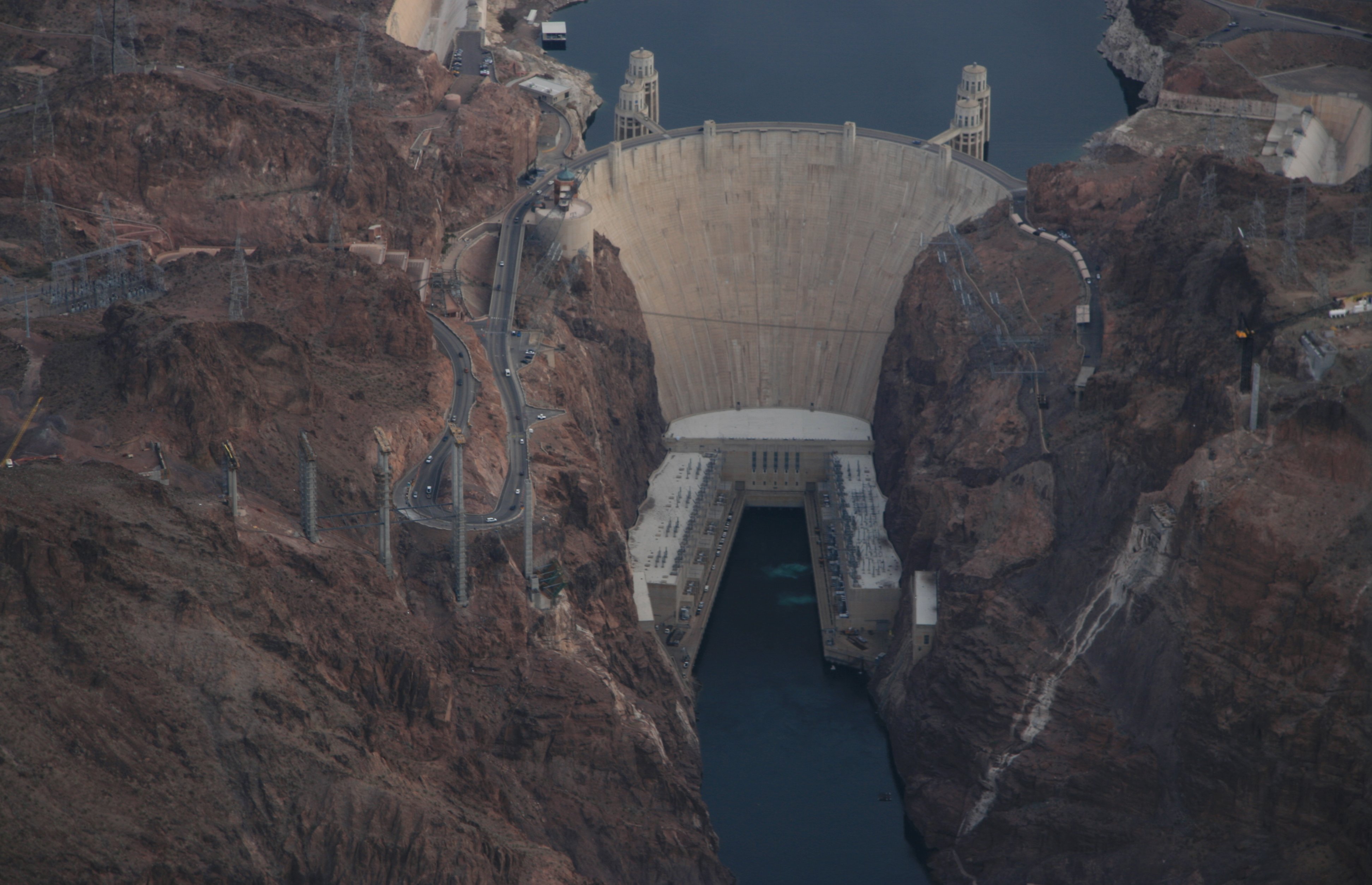
In the picture below you can see Lake Mead, Hoover Dam and the construction of the new bridge.

Another picture of Lake Mead below.
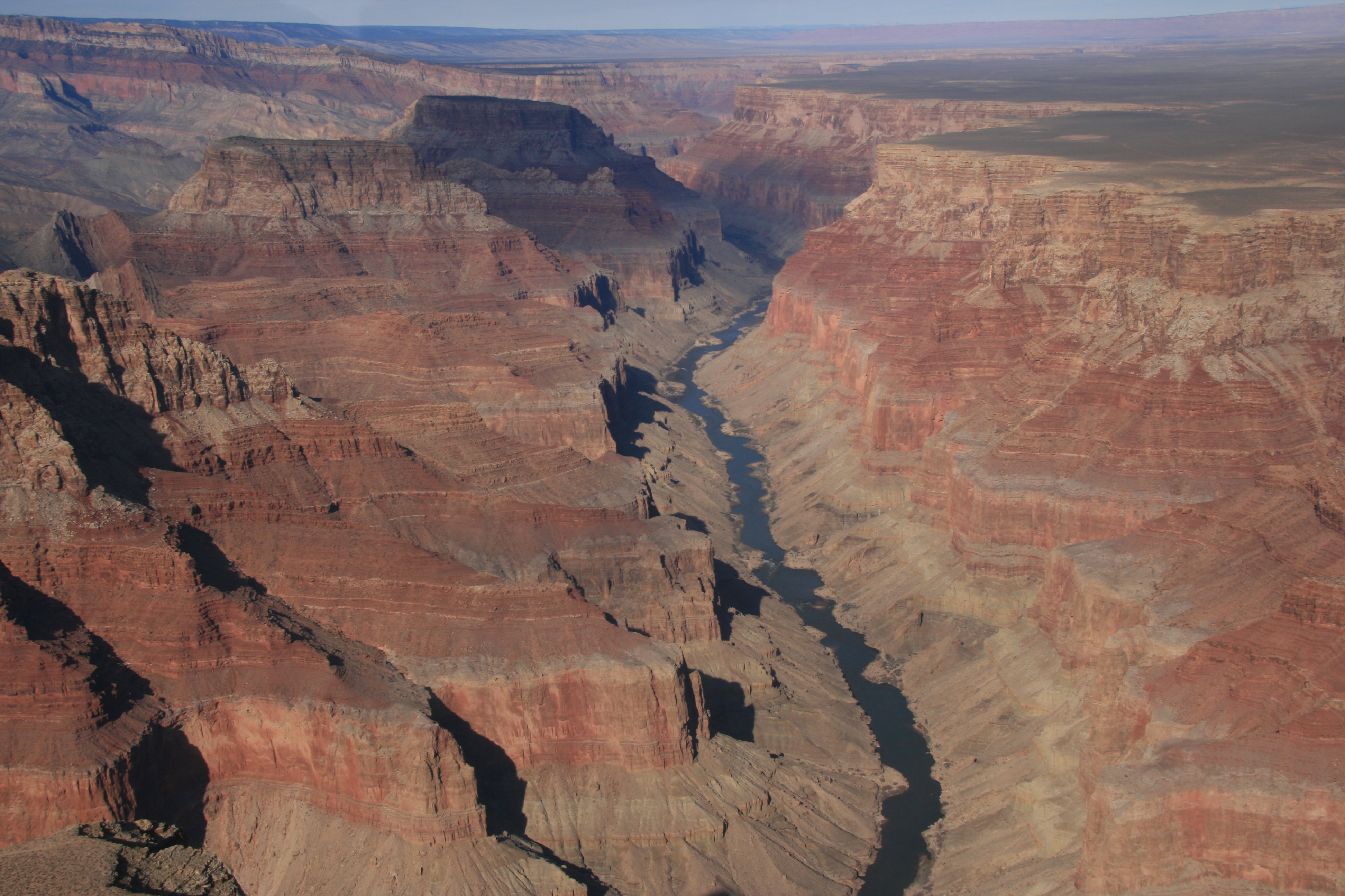
Below you get a nice view of the Colorado River snaking through the west end of the Grand Canyon.
We landed at the small Grand Canyon Airport.
After landing it was a short bus ride to the Grand Canyon where we had an hour to explore before having to get back to the airport. They dropped us off at the Bright Angel Lodge.
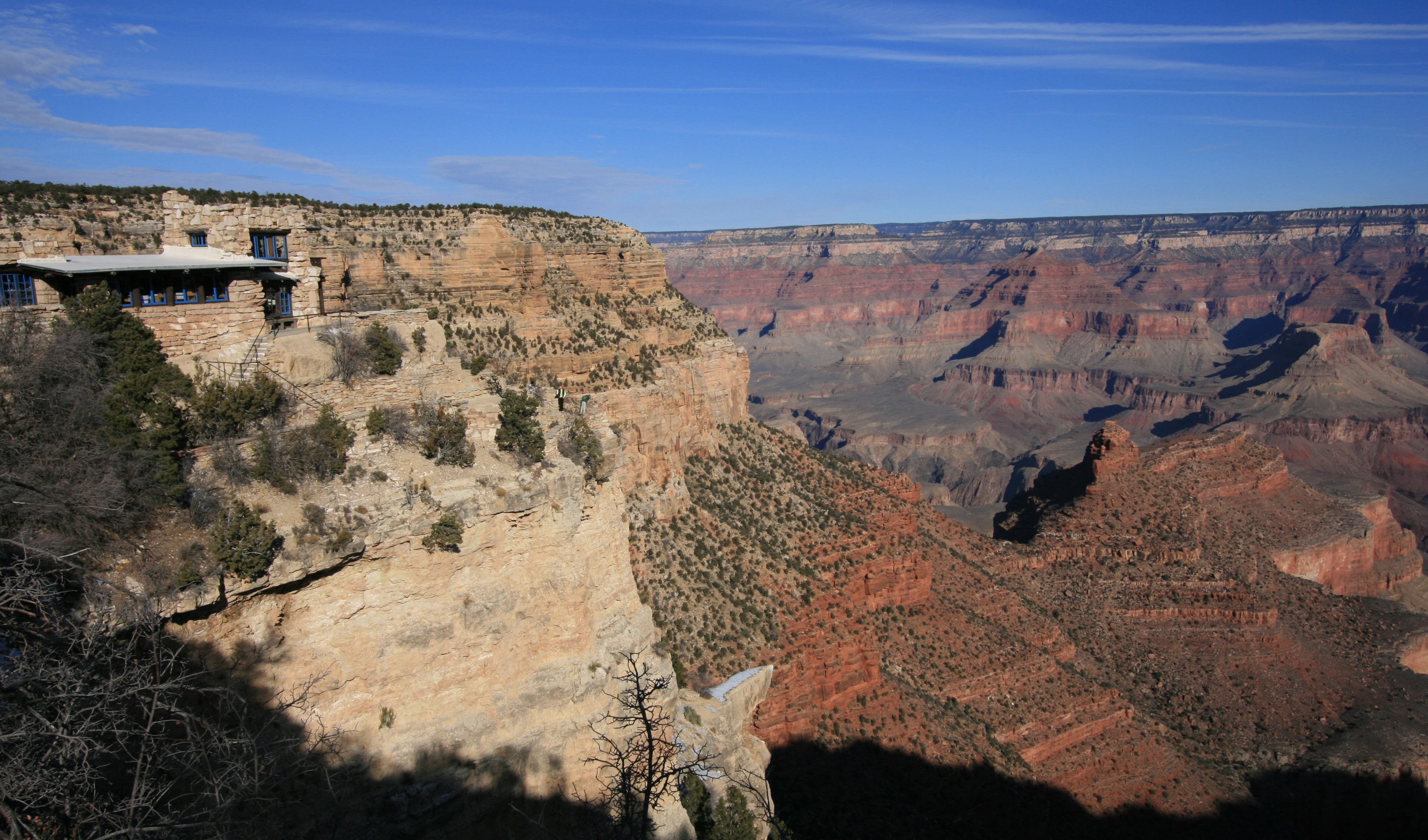
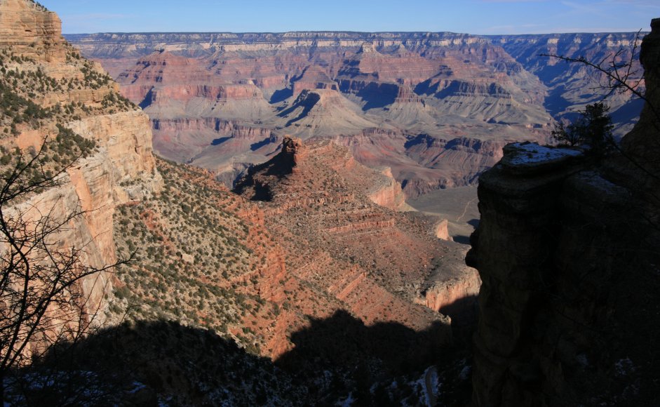
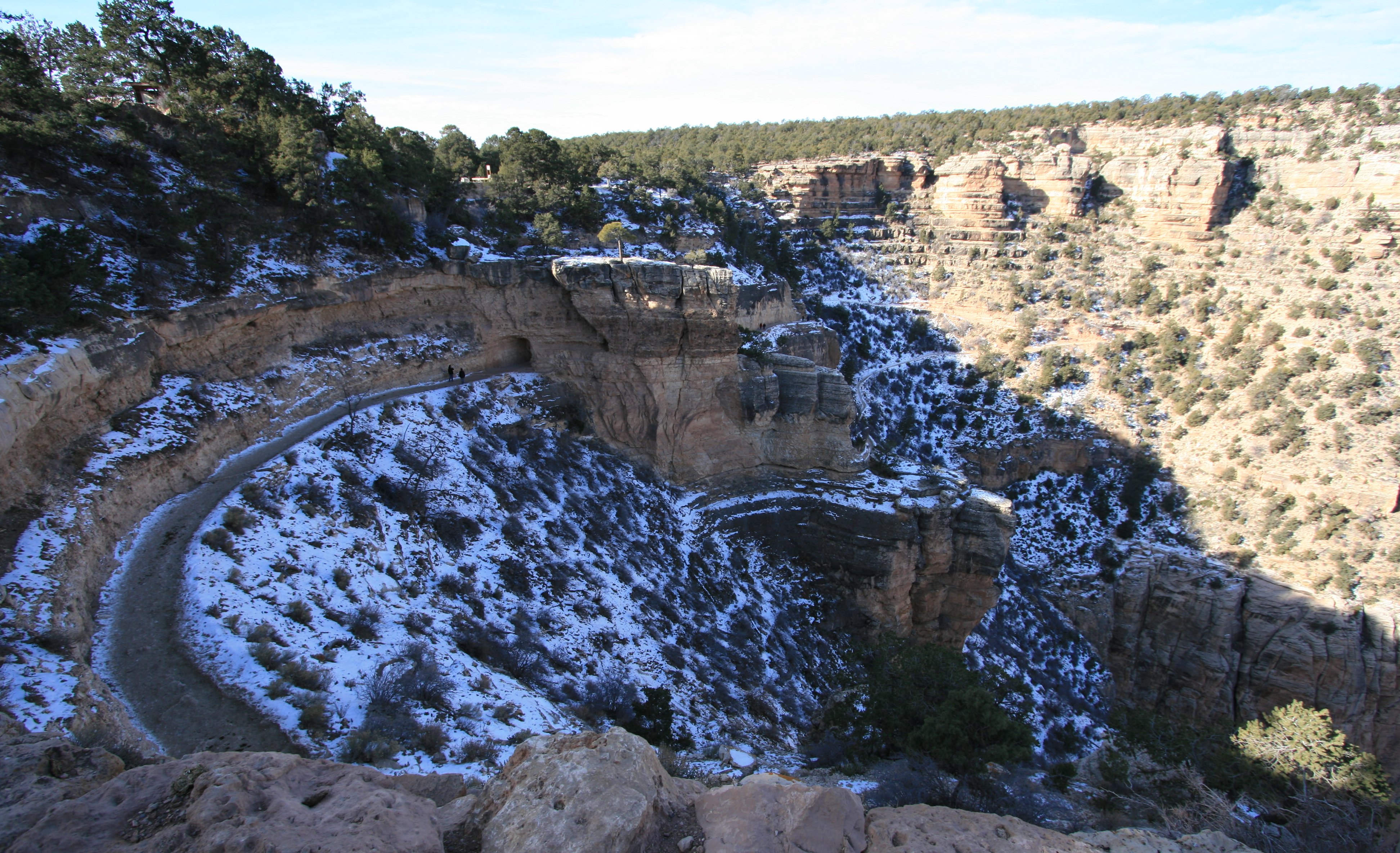
I was able to walk part of the way down Bright Angel Trail into the canyon before having to come back up. It would have been nice to have had a little more time to get further down into the canyon. Probably best that I didn't though, there was snow on the trail and I probably would have slid into the canyon at some point.
After the short drive back to the airport is was back on the plane for another hour and fifteen minute flight to Monument Valley. This was a spectacular flight. Below you can see us flying over Desert View Drive and approaching the rim of the Grand Canyon.
The weather was perfect as we flew directly over the Grand Canyon in several places.
I got several nice views of the Colorado River today.
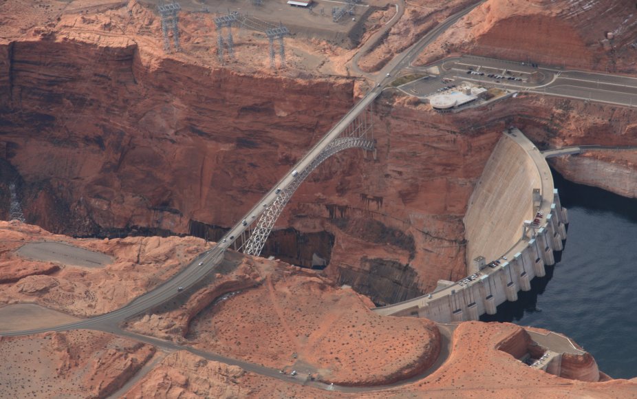
As we headed east we also flew over Glen Canyon, Glen Canyon Dam and Lake Powell.
Below is a nice view of the Glen Canyon Dam and U.S. Highway 89 going over the Glen Canyon Bridge.
Below you can see the Lake Powell side of the dam and the city of Page, Arizona at the top of the picture.
Lake Powell goes on for many miles.
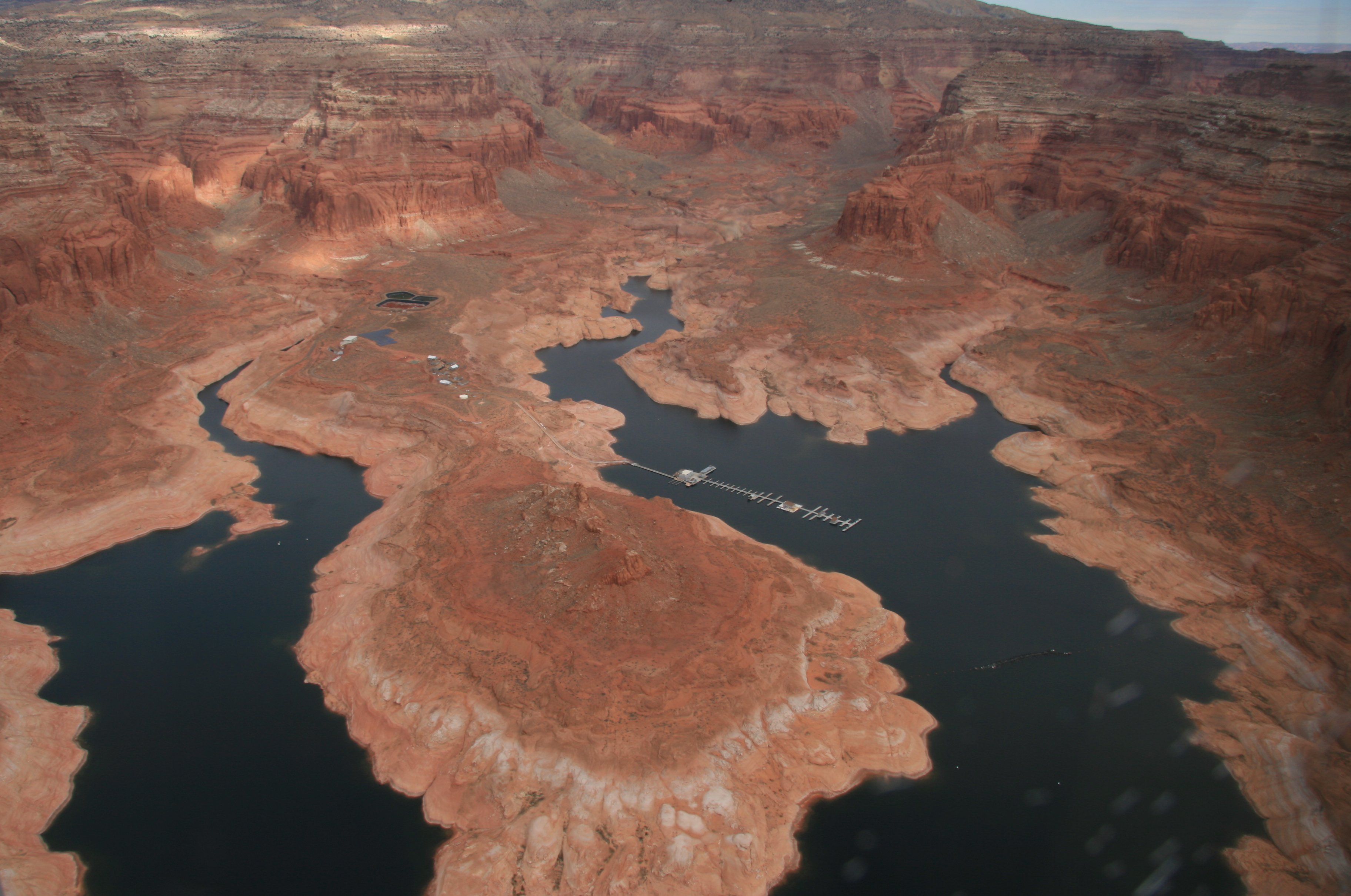
Below you can see the Marina on Lake Powell near Rainbow Bridge.
And pictured below is Rainbow Bridge.

We're flying along the Arizona/Utah Border.
Below we are approaching Monument Valley.
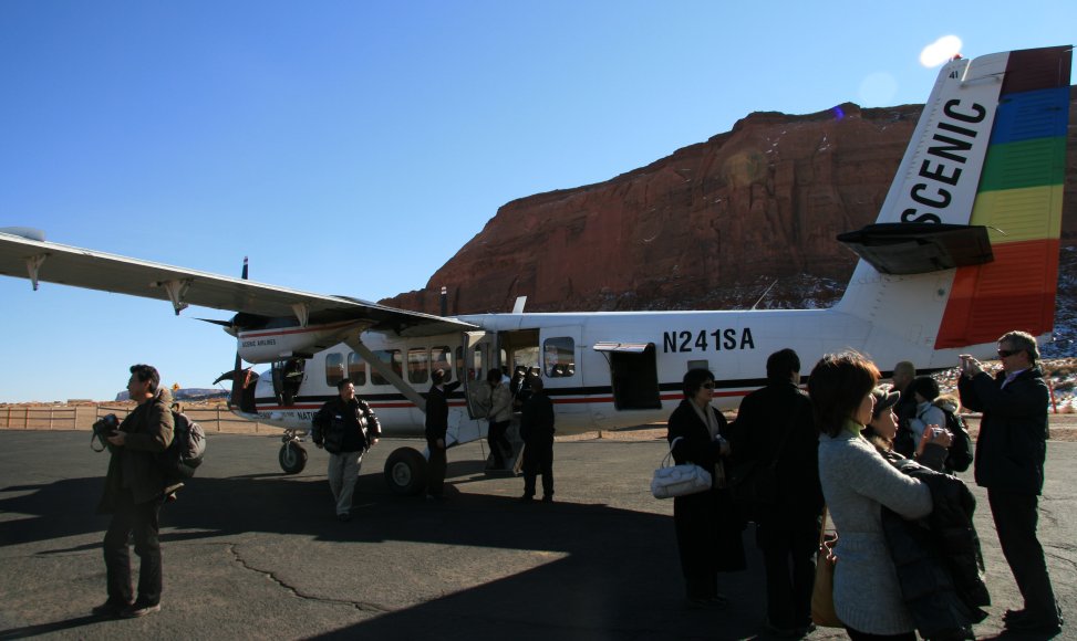
When the pilot announced that we were about to land I was puzzled as to where he planned to do that because there didn't appear to be an airport any where in sight. The airport consisted of one very small runway, a wind sock and that's it.
Below you can see our plane parked at the end of the runway in Monument Valley.
After landing we had lunch at a Goulding's and then had a very nice tour of Monument Valley.
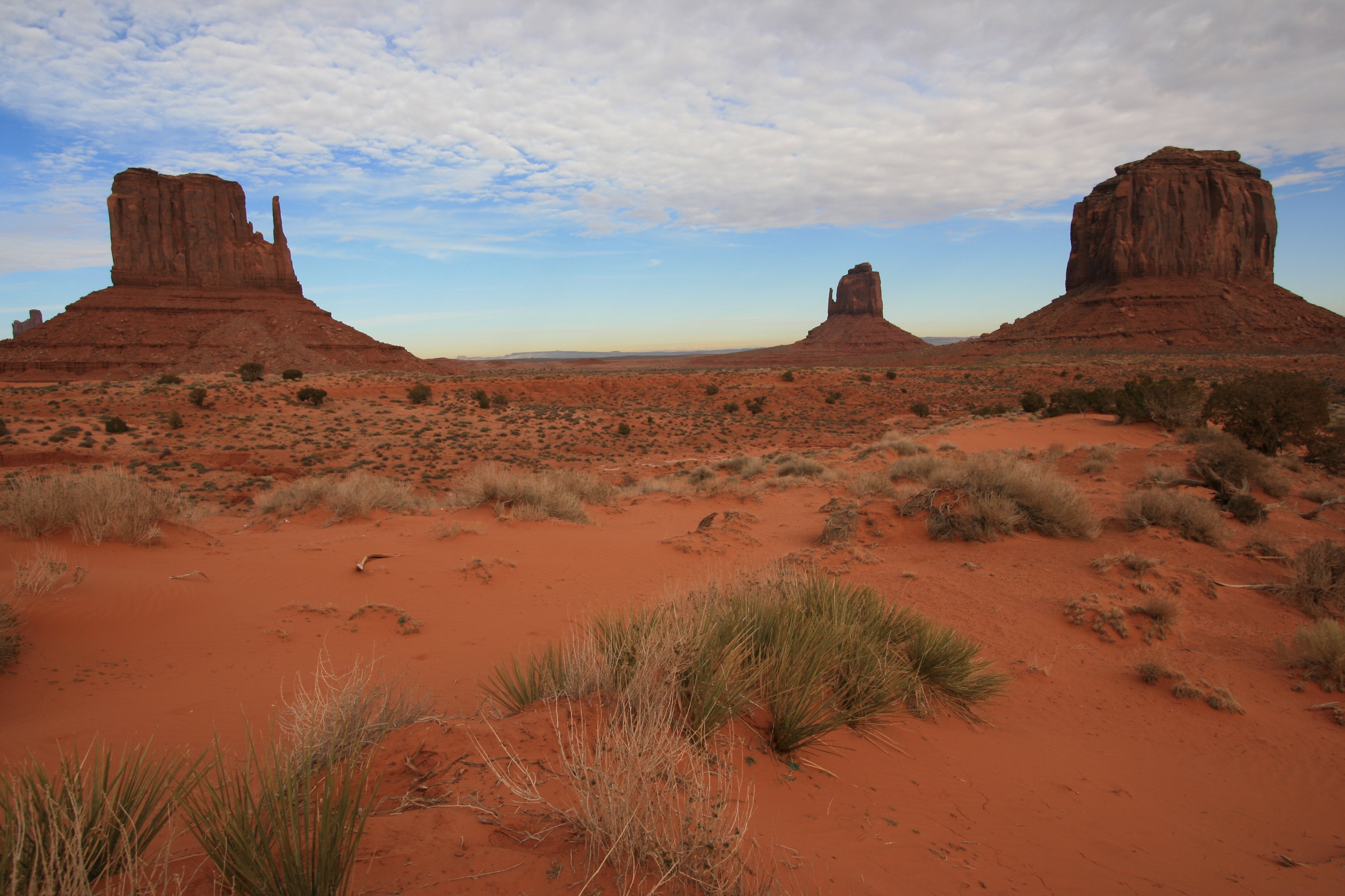
Below are the Mittens and Merrick Butte.
Below is the North Window.
The picture below is John Ford Point. Dozens of old westerns were filmed here.

That's me blocking the view of John Ford Point in the picture below.

It was back on the plane after the tour. The Pilot really had to get the plane in the air fast before that small "runway" ended. The picture below is looking back on Monument Valley.

Climbing above Monument Valley.
The color of the landscape on the flight back was much different as the sun was now setting. Below you can see Agathia Peak in the center of the picture.
The damn wing and engine blocked my view of the sunset.
We set down at the Grand Canyon Airport again for a quick refueling stop and then it was back in the air for the flight back to Las Vegas. Now completely dark, and I mean dark, not a light on in the plane and not a city or town within a hundred miles.
It was a long day, I had to get up at 4:30am and didn't get back to the hotel until after 7:30 tonight. But I got to see a lot of territory in three different states and spent five hours in the air. It was a blast. Don't look for any emails tomorrow. It's a 4 to 5 hour drive to Los Angeles, then at 10:30 tomorrow night it's a 15 hour flight to Sydney, Australia. So check your mailboxes in a couple of days for some reports from down under.
Tim
|